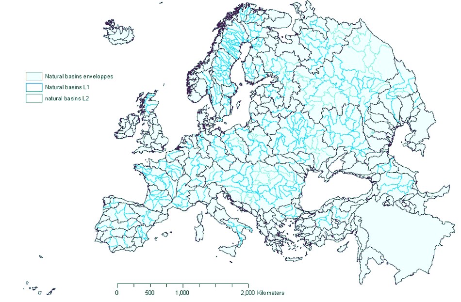
The EEA Catchments and Rivers Network System (ECRINS) is a dynamic set of map layers displaying the location and characteristics of hydrological features such as lakes, dams, abstraction points as well as monitoring stations and sewage treatment plants. It covers river catchment information over the previous ten years. The maps directly support environmental analysis such as water accounts and policy-making. For example, one layer delineates all river catchments, which is useful for those working to implement the European Union’s Water Framework Directive (WFD) at the river basin level.
The ECRINS package is a public good, so is available to anyone, including European institutions, national water agencies, scientists, businesses, students and NGOs active in environmental assessments. Users need GIS (Geographic Information System) software to access the map layers.
The ECRINS layers can be combined with others, such as those focusing on population or agriculture, to build an increasingly detailed picture of the influences on Europe’s water resources. It is hoped that this will allow users to answer a number of different questions, such as 'How many people live upstream of this lake?', 'What is the flow discharge at this point?', 'How many cubic metres of water are abstracted to irrigate fields?', 'What is the annual water balance for this basin?', 'What is the length of accessible rivers below that dam?'
“The ECRINS map layers will be an extremely important tool for understanding water resources in Europe,” EEA Executive Director Jacqueline McGlade said. “The maps cover the EU and EEA member countries, and include data from many others – in fact covering 70 % of rivers in 10 million km2 of river basins across continental Europe and the Middle East. Better access to information like this can help us use our finite water resources most wisely.”
ECRINS has been built on the Catchment Characterisation and Modelling (CCM) system developed by the European Commission’s Joint Research Centre (JRC) with a resolution of 1:250 000. The CCM has been completed with other layers with a resolution between 1:100 000 and 1:500 000.

The geographical coverage of ECRINS goes beyond EU-27 and the EEA Member countries. All of continental Europe west of the Urals, the Caucasus region and the Tigris-Euphrates river system is catalogued. It includes an improved catalogue of names, meaning that particular river systems with several local names may be easier to find.
The layers are available as Geodatabase files which can be opened with well-known programmes such as Microsoft Access and ArcGIS. They are also compatible with GDAL/OGR open source applications.

Document Actions
Share with others