next
previous
items

Figure

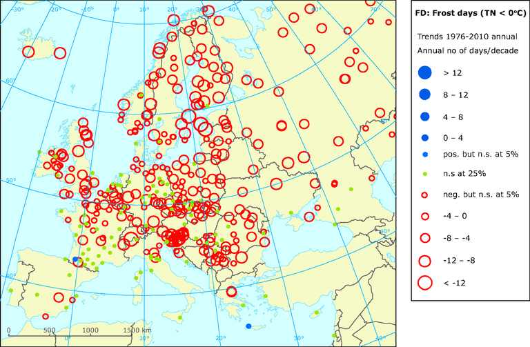
Observed changes in frost days indices 1976-2010 (in days per decade)

Figure Created 12 Apr 2011 Published 23 May 2011 Last modified 26 Aug 2017
1 min read
This is an old version, kept for reference only.

Go to latest version
This page was archived on 26 Aug 2017 with reason: A new version has been published
How to read the map: Frost day is defined as a day with an average temperature below 0 ºC. Stations with positive trends are in blue and stations with negative trend are in red colour. When stations are in green colour trends are not statistically significant at 25% level.

Download

European data

Metadata

Additional information

Positive values indicate cooling trend (increase in frequency) and negative values indicate a warming trend (decrease in frequency). The circle size depicts the magnitude of change in temperature per decade.
Geographical coverage note: Europe

Permalinks

Geographic coverage

Temporal coverage

Topics

Tags

Filed under:
Filed under: climate, csi, climate change
Document Actions