All official European Union website addresses are in the europa.eu domain.
See all EU institutions and bodiesAn official website of the European Union | How do you know?
Environmental information systems
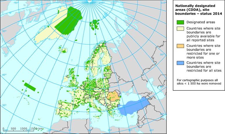
Nationally designated areas (CDDA), site boundaries - status 2014
Map (static)
The map is intended to show the distribution of site boundaries reported for nationally designated areas

Downloads
Data sources
Metadata
More info
Loading
- Albania
- Austria
- Belgium
- Bosnia and Herzegovina
- Bulgaria
- Croatia
- Cyprus
- Czechia
- Denmark
- Estonia
- Finland
- France
- Germany
- Greece
- Hungary
- Iceland
- Ireland
- Italy
- Kosovo (UNSCR 1244/99)
- Latvia
- Liechtenstein
- Lithuania
- Luxembourg
- North Macedonia
- Malta
- Montenegro
- Netherlands
- Norway
- Poland
- Portugal
- Romania
- Serbia
- Slovakia
- Slovenia
- Spain
- Sweden
- Switzerland
- Turkey
- United Kingdom
2014
The map should not be used for any purpose other than visualizing the designated areas at European scale and the country restrictions on dissemination of the data ifself.
This information is from the Nationally designated areas (CDDA) based on data provided by national sources. For any re-use of the map, please mention specifically the following copyright text for Estonia: "Estonian Environmental Register 25.02.2014" and for Finland: "©Finnish Environment Institute, 2014".
