All official European Union website addresses are in the europa.eu domain.
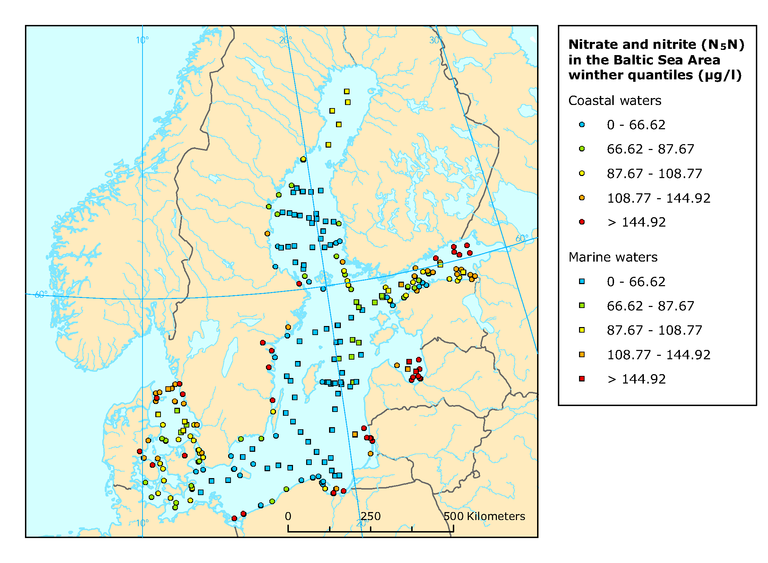
See all EU institutions and bodiesMean winter surface concentrations of nitrate and nitrite in the Baltic Sea Area, 2004
Map (static)
Mean winter surface concentrations of nitrate (combined nitrate and nitrite) in the Baltic Sea Area (1999-2004, 0-10 m, Jan-Feb, east of 15o E Jan-Mar)

Methodology
The map is based on a .dbf file named after its season-location (e.g. wintermeans_baltic.dbf containing winter Nitrate and Nitrite values from the Baltic Sea, incl. longitude/latitude by station). The name location part of the name has an "OW" fix if it contains Open Water data, otherwise data are form coastal stations. The column N5N or PO4 is used for wintermeans maps. The colours of the legend are based on the 20%, 40%, 60% and 80% percentiles of the indicator presented.
Additional information
Only stations with more than two years data are included. Coastal stations are marked by circles and ICES open-water stations (>20 km from coast) by squares. Level of classification is based on the 20 % 40 %, 60 % and 80 % percentiles of the indicator presented.
Geographical coverage note: The Baltic Sea
