All official European Union website addresses are in the europa.eu domain.
See all EU institutions and bodiesAn official website of the European Union | How do you know?
Environmental information systems
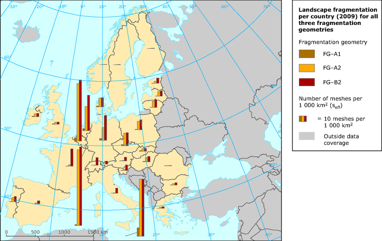
Landscape fragmentation per country for all three fragmentation geometries
Map (static)
Map shows the level of fragmentation in the 29 countries investigated

Downloads
Data sources
Metadata
More info
Loading
- Austria
- Belgium
- Bulgaria
- Cyprus
- Czechia
- Denmark
- Estonia
- Finland
- France
- Germany
- Greece
- Hungary
- Ireland
- Italy
- Latvia
- Lithuania
- Luxembourg
- Malta
- Netherlands
- Poland
- Portugal
- Romania
- Slovakia
- Slovenia
- Spain
- Sweden
- Switzerland
- United Kingdom
2009
Methodology
Fragmentation geometry has been created from input data (TeleAtlas roads/rails, CLC urban classes, mountain areas / mountain ridges based on Nordregio and WorldClim data and rivers/lakes based on Catchment Characterisation and Modelling (CCM) v.2 database and CLC database) and landscape fragmentation metrics (Jaeger 2000) has been calculated
