All official European Union website addresses are in the europa.eu domain.
See all EU institutions and bodies
An official website of the European Union | How do you know?
Environmental information systems
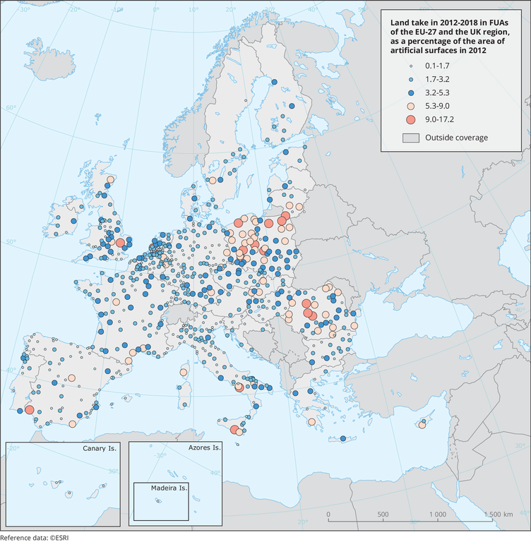
Land take is derived from comparing the Urban Atlas 2012 and 2018 datasets of the Copernicus Land Monitoring Service. Land take is expressed as the converted area in % of the 2012 land cover extent (% of non-urban land cover in 2012 that is converted to urban land cover by 2018). The dataset covers the entire EEA-39 region but Figure 2.5 only presents EU-27+UK countries.
Loading