All official European Union website addresses are in the europa.eu domain.
See all EU institutions and bodies
An official website of the European Union | How do you know?
Environmental information systems
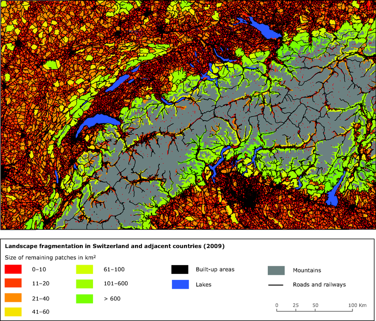
The barriers are shown in black (built-up areas, roads, railways), and the colours indicate the sizes of the remaining patches in the landscape. Lake Constance and Lake Geneva are visible at the top and on the left of the map, respectively. In FG-B2, the lakes and mountains were considered as barriers, but were not included in the reporting units.
Loading