All official European Union website addresses are in the europa.eu domain.
See all EU institutions and bodiesAn official website of the European Union | How do you know?
Environmental information systems
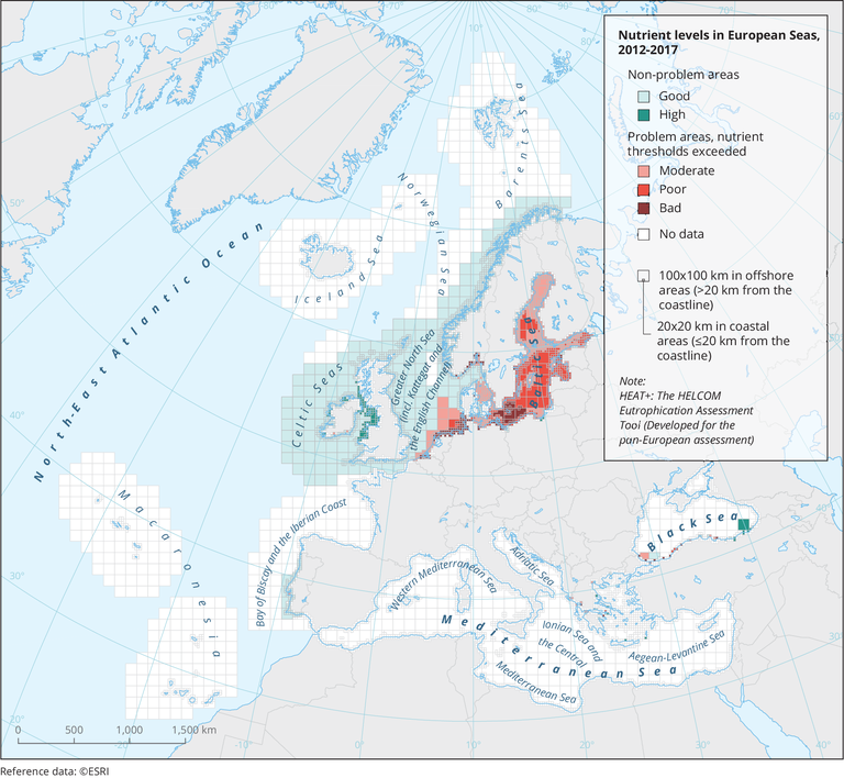
Nutrient levels in European seas, 2012 - 2017
Map (static)

Mapping of spatial variations in the classifications of ‘nutrient levels’ based on available monitoring data, threshold values and the Heat+ assessment. Heat+ is the HELCOM Eutrophication Assessment Tool.
Downloads
Data sources
Metadata
More info
Loading
- Adriatic Sea
- Aegean Sea
- Baltic Sea
- Barentsz Sea
- Black Sea
- Celtic Sea
- Ionian Sea
- Mediterranean Sea
- North Atlantic Ocean
- Norwegian Sea
2012-2017
