All official European Union website addresses are in the europa.eu domain.
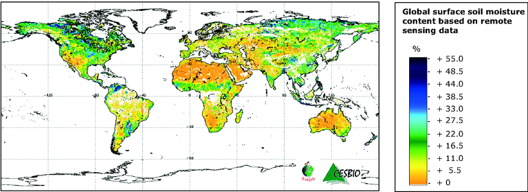
See all EU institutions and bodiesSMOS provides a global image of surface soil moisture every three days; this map covers the period 8–15 June 2010. Yellow colours indicate drier soil surfaces; blue colours denote wetter conditions. SMOS can measure soil moisture levels to an
accuracy of 4 % at a spatial resolution of 50 km — about the same as detecting a teaspoonful of water mixed into a handful of dry soil.
Loading

