All official European Union website addresses are in the europa.eu domain.
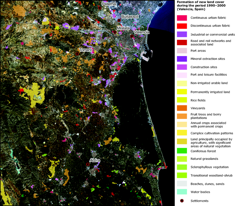
See all EU institutions and bodiesColoured areas on the image show where land cover change occurred between 1990 and 2000
Loading
All official European Union website addresses are in the europa.eu domain.
See all EU institutions and bodiesMap (static)
Coloured areas on the image show where land cover change occurred between 1990 and 2000

The image shows the situation in 2000, and highlights the areas where new types of land cover have been formed (see legend). Land cover across the other parts of the satellite image have been classified as unchanged according to the CLC methodology, which maps change only for parcels that exceed 5 hectares. The unchanging areas are not shown and so the satellite image "shows through".