All official European Union website addresses are in the europa.eu domain.
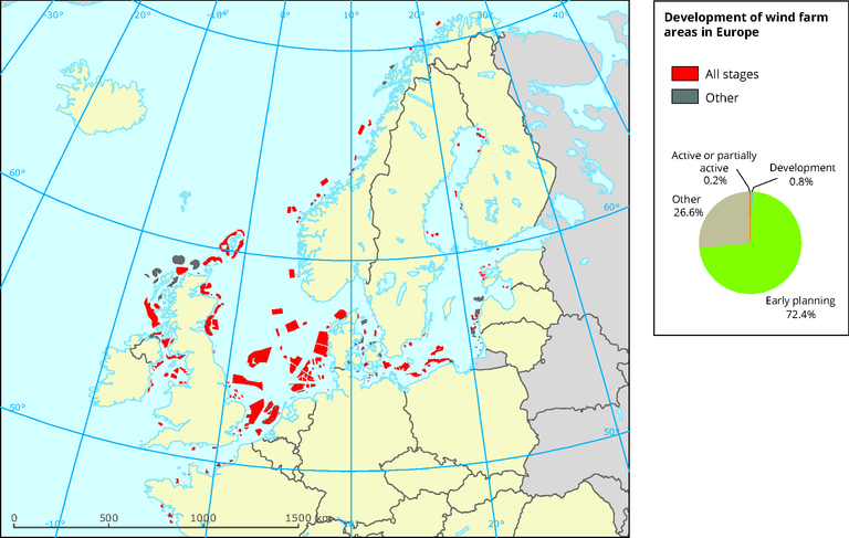
See all EU institutions and bodiesDevelopment of wind farm areas in Europe
Map (static)
The map provides an overview of wind farm areas in all stages of development in Europe. The pie chart shows the different levels of development %.

- Wind farm ares
- Baltic Sea
- Celtic Sea
- English Channel
- Kattegat
- North Sea
- Norwegian Sea
Methodology
GDB; column names: 'Shape_Leng'´, Shape_Area', 'WindFarm_1' 'area_skm', which columns to join; column 'WindfarmSt' was reclassified: Active or partially active describes wind farms which are ‘generating power’ or ‘partial generation/under construction’; Development includes those which are considered to ‘have authorised consent’ or be ‘under construction’; and Early development includes those which were described as ‘concept, early planning’, ‘consent application submitted’ and ‘development zone’, Other includes ‘cancelled’, ‘decommissioned’, ‘dormant’ and ‘failed proposal’; column 'WindFarm_1' to use for the legend classification, changes: area calculated and expressed in square kilometers
