All official European Union website addresses are in the europa.eu domain.
See all EU institutions and bodiesAn official website of the European Union | How do you know?
Environmental information systems
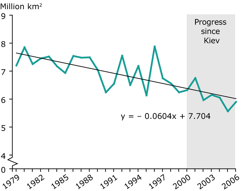
Change in September Arctic sea-ice extent
Chart (static)
The 'extent' column includes the area near the pole not imaged by the sensor

Downloads
Data sources
Metadata
More info
Loading
- NOAA satellite images - Arctic sea ice index
It is assumed to be entirely ice covered with at least 15 % concentration. However, the 'area' column excludes the area not imaged by the sensor. This area is 1.19 million km2 for SMMR (35) (from the beginning of the series through June 1987) and 0.31 million square kilometres for SSM/I (36) (from July 1987 to present). Therefore, there is a discontinuity in the 'area' data values in this file at the June/July1987 boundary.
