All official European Union website addresses are in the europa.eu domain.
See all EU institutions and bodies
An official website of the European Union | How do you know?
Environmental information systems
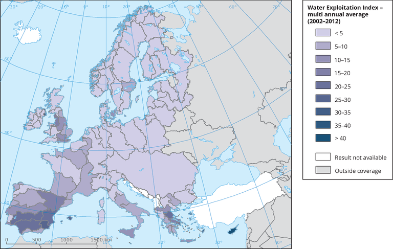
The water exploitation index plus has been calculated as a multi-annual average per river basin district, for the years 2002-2012, as defined in ECRINS. The ECRINS delineation of river basin districts differs from those defined by Member States under the Water Framework Directive, particularly for transboundary river basin districts.
Click on the "downloads and more info" button below to see the dynamic map with time slider, which provides information on water abstraction by source and water use by sector at sub-basin or river basin scale.
Loading