All official European Union website addresses are in the europa.eu domain.
See all EU institutions and bodies
An official website of the European Union | How do you know?
Environmental information systems
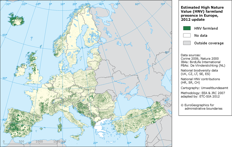
How to read the map: Green areas show likelihood to contain primarily HNV land, on the basis of a stratified selection of CORINE land cover clases per country and environmental zone, and national biodiversity data when available. The values in the map are a proxy for the proportion of HNV in each 1 km2 cell, 2012 update.
Loading