All official European Union website addresses are in the europa.eu domain.
See all EU institutions and bodiesAn official website of the European Union | How do you know?
Environmental information systems
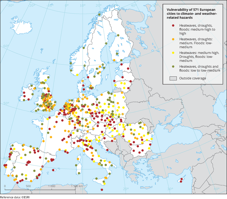
Vulnerability of 571 European cities to climate- and weather-related hazards
Map (static)
The map shows the vulnerability of European cities (selected) to climate hazards: heatwaves, droughts and floods

Downloads
Data sources
Metadata
More info
Loading
- City clusters based on different combinations of threat-specific vulnerability scores
- Austria
- Belgium
- Bulgaria
- Croatia
- Cyprus
- Czechia
- Denmark
- Estonia
- Finland
- France
- Germany
- Hungary
- Ireland
- Italy
- Latvia
- Lithuania
- Luxembourg
- Malta
- Netherlands
- Norway
- Poland
- Portugal
- Romania
- Slovakia
- Slovenia
- Spain
- Sweden
- Switzerland
- United Kingdom
2017
Based on investigation into 571 European cities included in the GISCO Urban Audit 2004 Database. The information for individual cities included in this analysis, following the original classification into seven clusters, is available through the Urban Adaptation Map Viewer (factsheets).
Source: Adapted from Tapia et al. (2017).
