All official European Union website addresses are in the europa.eu domain.
See all EU institutions and bodies
An official website of the European Union | How do you know?
Environmental information systems
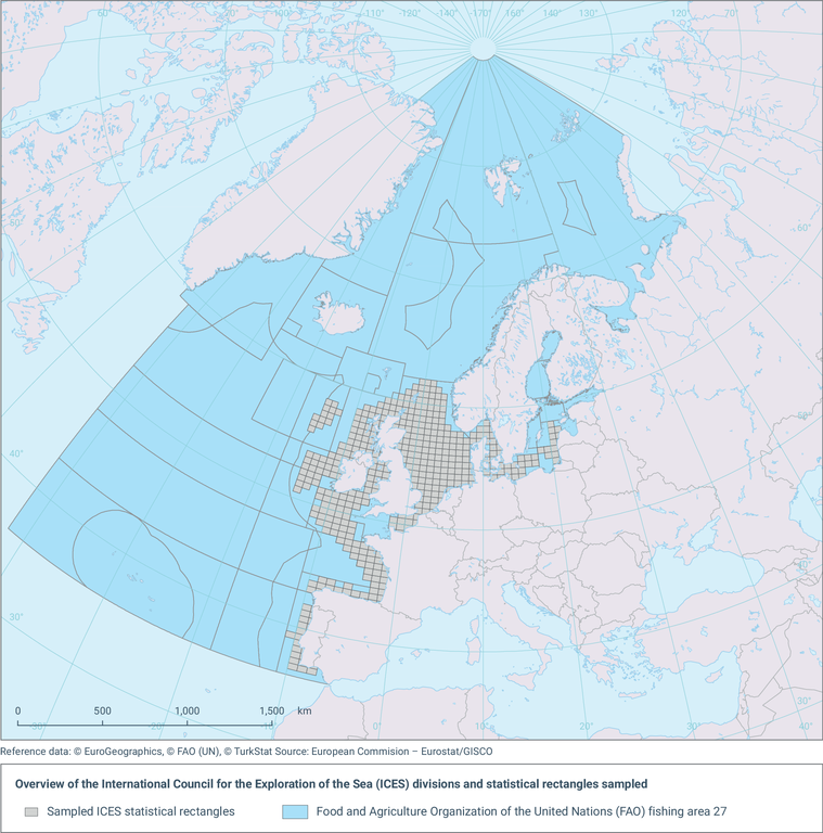
The map shows the International Council for the Exploration of the Sea (ICES) rectangles covered by the Database Trawl Surveys (DATRAS) surveys over the period analysed (1967-2022).
Loading