All official European Union website addresses are in the europa.eu domain.
See all EU institutions and bodies
An official website of the European Union | How do you know?
Environmental information systems
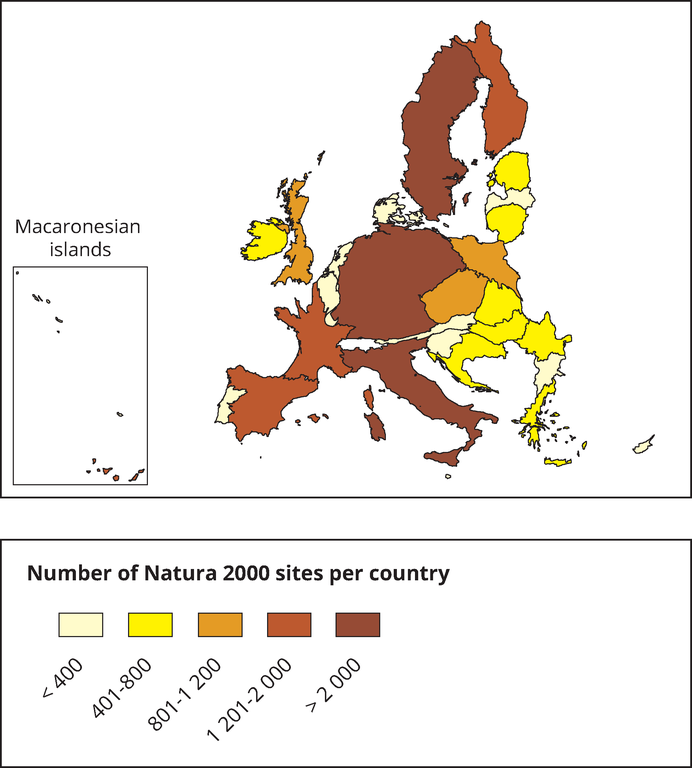
This map is a cartogram that distorts the geometry of regions to convey specific information by resizing. The box on the bottom left refers to the Macaronesian islands (Azores, Madeira and Canary Islands). It only includes terrestrial Natura 2000 sites for EU-28 (SPAs, SACs, SCIs and proposed SCIs).
Loading