All official European Union website addresses are in the europa.eu domain.
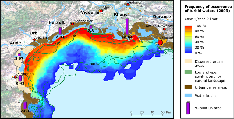
See all EU institutions and bodiesFrequency of occurrence of turbid waters (from 0 to 100 %) along the coast between Marseille and the Spanish border (2003)
Map (static)

Methodology
Ocean colour imagery is used to delineate turbid from clear water masses on a daily basis. Therefore daily mapping of turbid areas is made available and when gathered over one year allow deriving statistics on turbid water locations. The delivered product consists of regional seas mapping of statistics of turbid waters occurrence. This turbidity results from the extension of river plumes (main inputs are reported on the maps), and also from re-suspension (due to wave action) of sediments from the bottom in shallow waters. The results here have been derived from ENVISAT/MERIS data over the year 2003. The on-ground spatial resolution is 2 km. The detection of "turbid" water is based on a threshold value of water reflectivity at given wavelength of the spectrum equivalent to a sediment concentration of 0.75g/m3. Turbid water index is an operational product of the Coastal GMES Service Element Coastwatch/Marcoast.
