All official European Union website addresses are in the europa.eu domain.
See all EU institutions and bodiesAn official website of the European Union | How do you know?
Environmental information systems
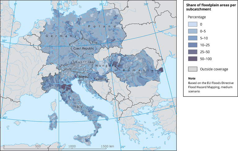
Floodplain distribution
Map (static)
Floodplain percentage per subcatchment.

Downloads
Data sources
Metadata
More info
Loading
- Flood Hazard and Risk map, medium probability (Dataset URL is not available)
- Catchment characterisation and modelling 2 (CCM2)
Methodology
FHM areas have been intersected with CCM2 WSO4 subcatchments. Percentage of FHM areas per subcatchment have been calculated and classified in 6 classes.
Additional information
Spatial data reported under FD obligation "Flood hazard and flood risk maps" (FD, Article 6) have been compiled into one dataset with medium scenario probability for 9 selected countries. Percentage of flood hazard area (medium probability) per subcatchment used as proxy for floodplain coverage.
