All official European Union website addresses are in the europa.eu domain.
See all EU institutions and bodies
An official website of the European Union | How do you know?
Environmental information systems
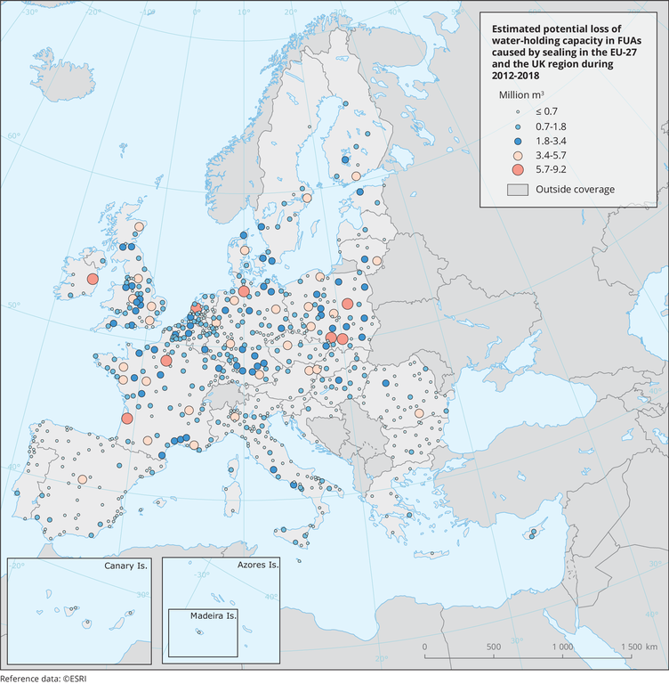
The map visualizes water holding capacity loss due to the estimated soil sealing increase during 2012 and 2018 in FUAs. Although the figure presents EU27+UK values only, data is available for the EEA-38 region and the UK.
Loading