All official European Union website addresses are in the europa.eu domain.
See all EU institutions and bodies
An official website of the European Union | How do you know?
Environmental information systems
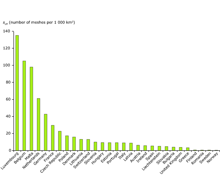
Effective mesh density values by country for Fragmentation Geometry FG-B2 in 2009. Fragmentation geometry has been created from input data (TeleAtlas roads/rails, CLC urban classes, mountain areas / mountain ridges based on Nordregio and WorldClim data and rivers/lakes based on Catchment Characterisation and Modelling (CCM) v.2 database and CLC database) and landscape fragmentation metrics (Jaeger 2000) has been calculated.
Loading